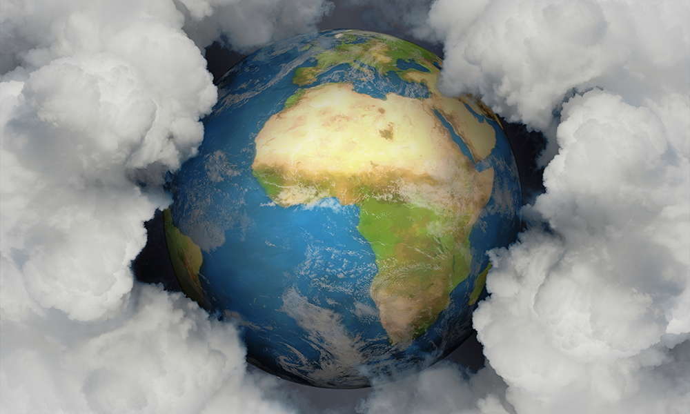
Where is Africa?
Africa is the world’s second largest continent and contains over 50 countries.
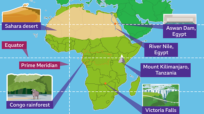
Africa is in the Northern and Southern Hemispheres. It is spread across three of the major lines of latitude: the Tropic of Cancer, the Equator and the Tropic of Capricorn. The north of Africa shares a boundary with Asia.
Africa is surrounded by the Indian Ocean in the east, the South Atlantic Ocean in the south-west and the North Atlantic Ocean in the north-west.
Algeria is the largest country by area in Africa and Nigeria is the largest country by population.
Africa is surrounded by the Indian Ocean in the east, the South Atlantic Ocean in the south-west and the North Atlantic Ocean in the north-west.
Algeria is the largest country by area in Africa and Nigeria is the largest country by population.
Physical geography
Africa is a large continent and it has a range of climate zones and biomes.
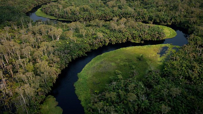
The Congo rainforest in Africa is one of the world’s largest rainforests. Like other tropical rainforests such as the Amazon, it is located close to the Equator, where the sun’s energy is more direct.
As the sun’s energy is very strong in the Congo rainforest, water evaporates (turns from a liquid to a gas) and rises high into the atmosphere. As it rises, it becomes cooler, condenses back to a liquid, and falls to the ground as rainfall. This process happens over and over again, creating a hot and wet climate.
Other biomes in Africa include the Mediterranean forest, savannah and grassland.
The African Savannah has a hot dry climate. During the dry season the grasses can shrivel up. Animals like wildebeests to migrate (move location) in their search for food. This happens in countries such as Kenya and Tanzania.
Not all of Africa is hot all the year around. High mountains such as Mount Kilimanjaro often have snow at their summit. Although mostly a hot continent, snow can fall in mountain regions. These areas include the Atlas Mountains of Morocco, Tunisia and Algeria, and the Rwenzori Mountains between Uganda and the Democratic Republic of the Congo.
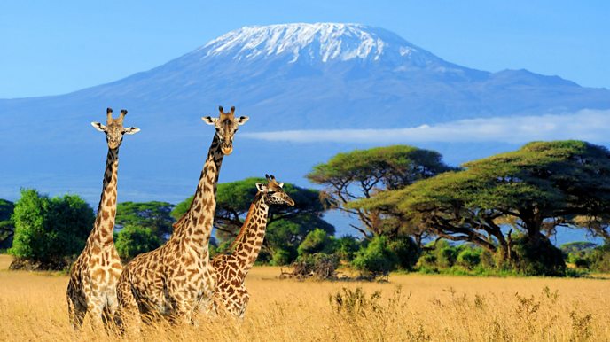
Mount Kilimanjaro, Tanzania
The Sahara desert
The Sahara Desert is the world’s largest hot desert, located in northern Africa. The climate is hot and dry, with temperatures recorded as high as 50°C.
Some areas of the Sahara may go many years without a single drop of rain.
Only plants and animals that have specially adapted can survive in the desert. These include dromedaries, which are one-humped camels able to survive up to 15 days without water.
Human geography
The largest cities in Africa include Lagos (in Nigeria), Kinshasa (in the Democratic Republic of Congo), Cairo (in Egypt) and Johannesburg (in South Africa).
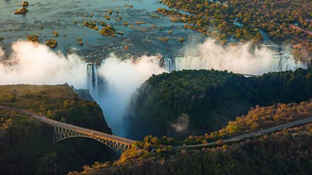
Famous human-made landmarks include Victoria Falls Bridge (between Zambia and Zimbabwe), the Great Pyramids of Giza (in Egypt) and Timgad ruins (in Algeria).
Aswan Dam, across the river Nile in Egypt, is the world’s largest embankment dam. A dam is a barrier that blocks water to create a human-made lake called a reservoir. Dams can be used to produce hydroelectric power which is a form of renewable energy.
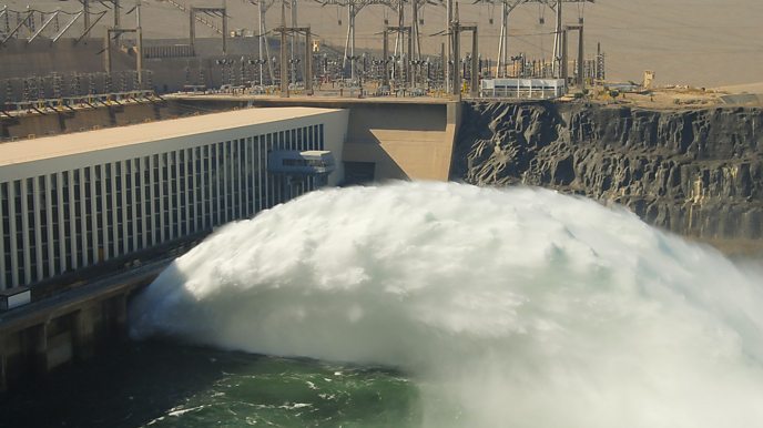
Aswan Dam was built to help control the flow of water from the Nile during the annual flooding season.
Moving water from the dam is used to power turbines and produce electricity. The reservoir supplies water during droughts. The water is also used to irrigate crops.
___
Source here